 Historic Marker
Marker · Memory
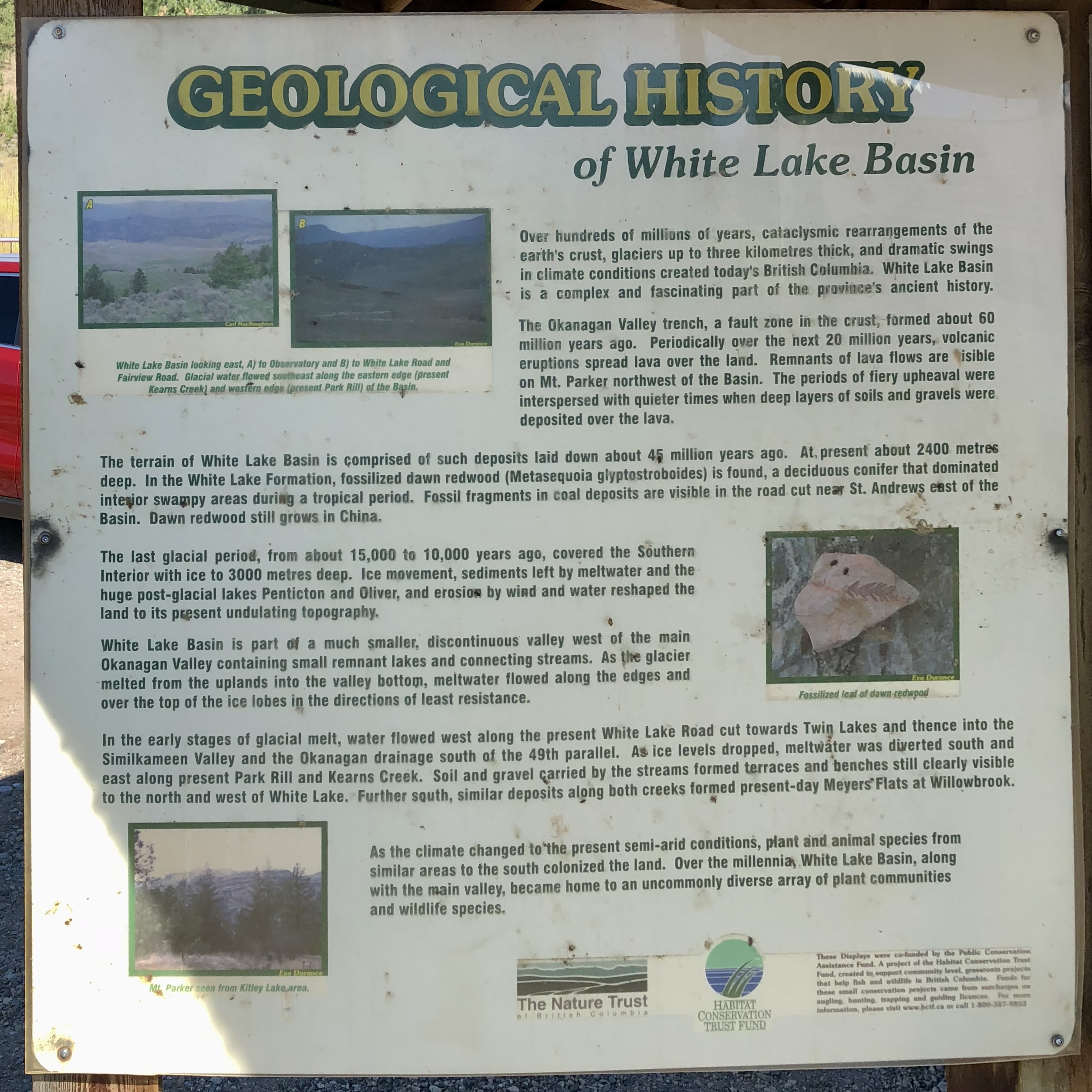
Geological History of White Lake Basin
Inscription
GEOLOGICAL HISTORY of White Lake Basin Over hundreds of millions of years, cataclysmic rearrangements of the earth's crust, glaciers up to three kilometres thick, and dramatic swings in climate conditions created today's British Columbia. White Lake Basin is a complex and fascinating part of the province's ancient history. [Photo: White Lake Basin looking east, A) to Observatory and B) to White Lake Road and Fairview Road. Glacial valley flowed southwest along the western edge (present Keogan Creek) and swiftly tides (present Park Rill) of the Right.] The Okanagan Valley trench, a fault line in the crust, formed about 60 million years ago. Periodically over the next 20 million years, volcanic eruptions spread lava over the land. Remnants of lava flows are visible on Mt. Parker northwest of the Basin. The periods of fiery upheaval were interspersed with quieter times when deep layers of soils and gravels were deposited over the lava. The terrain of White Lake Basin is comprised of such deposits laid down about 45 million years ago. At present about 2400 metres deep. In the White Lake Formation, fossilized dawn redwood (Metasequoia glyptostroboides) is found, a deciduous conifer that dominated interior swampy areas during a tropical period. Fossil fragments in coal deposits are visible in the road cut near St. Andrews east of the Basin. Dawn redwood still grows in China. [Photo: Fossilized leaf of dawn redwood] The last glacial period, from about 15,000 to 10,000 years ago, covered the Southern Interior with ice to 3000 metres deep. Ice movement, sediments left by meltwater and the huge post-glacial lakes Penticton and Oliver, and erosion by wind and water reshaped the land to its present undulating topography. White Lake Basin is part of a much smaller, discontinuous valley west of the main Okanagan Valley containing small remnant lakes and connecting streams. As the glacier melted from the uplands into the valley bottom, meltwater flowed along the edges and over the top of the ice lobes in the directions of least resistance. In the early stages of glacial melt, water flowed west along the present White Lake Road cut towards Twin Lakes and thence into the Similkameen Valley and the Okanagan drainage south of the 49th parallel. As ice levels dropped, meltwater was diverted south and east along present Park Rill and Keogan Creek. Soil and gravel carried by the streams formed terraces and benches still clearly visible to the north and west of White Lake. Further south, similar deposits along both creeks formed present-day Meyers Flats at Willowbrook. As the climate changed to the present semi-arid conditions, plant and animal species from similar areas to the south colonized the land. Over the millennia, White Lake Basin, along with the main valley, became home to an uncommonly diverse array of plant communities and wildlife species. [Photo: Aerial overview from Killey Lake area] [Photo: Cattle at Meyers Flats south of the Basin] These Displays were produced by the Public Conservation Assistance Fund. A project of the Habitat Conservation Trust Fund, Help Bell Fish and Wildlife in British Columbia. Contributions come from surcharges on hunting and angling licences and from donations to the Trust Fund. For more information, please visit www.hctf.ca or call 1-800-387-9853 The Nature Trust HABITAT CONSERVATION TRUST FUND
Awaiting verification
Record
- Marker type
- Sign
- Current condition
- Good, as of the 2018 survey
- Location
- Dominion Radio Astrophysical Observatory — White Lake, British Columbia
- Added to the archive
- July 22, 2018
Interpretive sign explaining the geological history of the White Lake Basin, including glacial periods, volcanic activity, and the formation of the unique landscape.
Condition over time