 Historic Marker
Marker · Memory
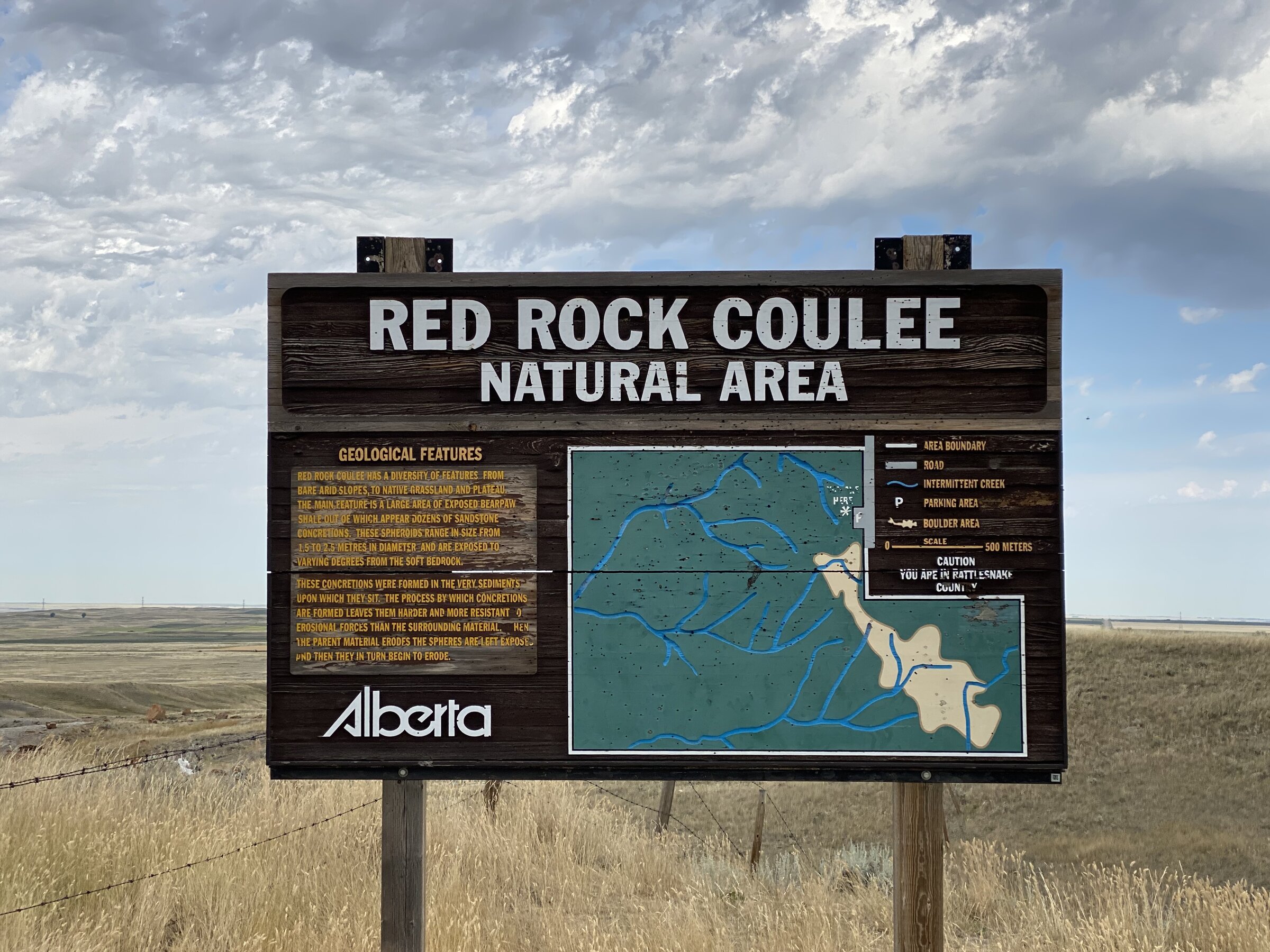
Red Rock Coulee Entrance Sign
Interpretive sign at the entrance to Red Rock Coulee Natural Area
Inscription
RED ROCK COULEE NATURAL AREA GEOLOGICAL FEATURES RED ROCK COULEE HAS A DIVERSITY OF FEATURES FROM BARE ARID SLOPES, TO NATIVE GRASSLAND AND PLATEAU THE MAIN FEATURE IS A LARGE AREA OF EXPOSED BEARPAW SHALE OUT OF WHICH APPEAR DOZENS OF SANDSTONE CONCRETIONS. THESE SPHEROIDS RANGE IN SIZE FROM 1.5 TO 2.5 METRES IN DIAMETER AND ARE EXPOSED TO VARYING DEGREES FROM THE SOFT BEDROCK. THESE CONCRETIONS WERE FORMED IN THE VERY SEDIMENTS UPON WHICH THEY SIT. THE PROCESS BY WHICH CONCRETIONS ARE FORMED LEAVES THEM HARDER AND MORE RESISTANT EROSIONAL FORCES THAN THE SURROUNDING MATERIAL. HEN THE PARENT MATERIAL ERODES THE SPHERES ARE LEFT EXPOSE PND THEN THEY IN TURN BEGIN TO ERODE. Alberta AREA BOUNDARY ROAD INTERMITTENT CREEK PARKING AREA BOULDER AREA SCALE CAUTION 500 METERS YOU ARE IN RATTLESNAKE [UNVERIFIABLE: 3 short fragments elsewhere on this sign could not be corroborated and are not shown]
Machine-transcribed from photo · not yet human-verified · may be incomplete
Record
- Marker type
- Sign
- Current condition
- Good, as of the 2020 survey
- Location
- Red Rock Coulee Natural Area — County of Forty Mile, Alberta
- Added to the archive
- January 25, 2026
The main entrance sign for Red Rock Coulee Natural Area, providing information about the geological features of the site including the formation of the distinctive sandstone concretions.
Condition over time